
Solutions
Delivery management solutions
Transform your delivery management with real-time visibility and control


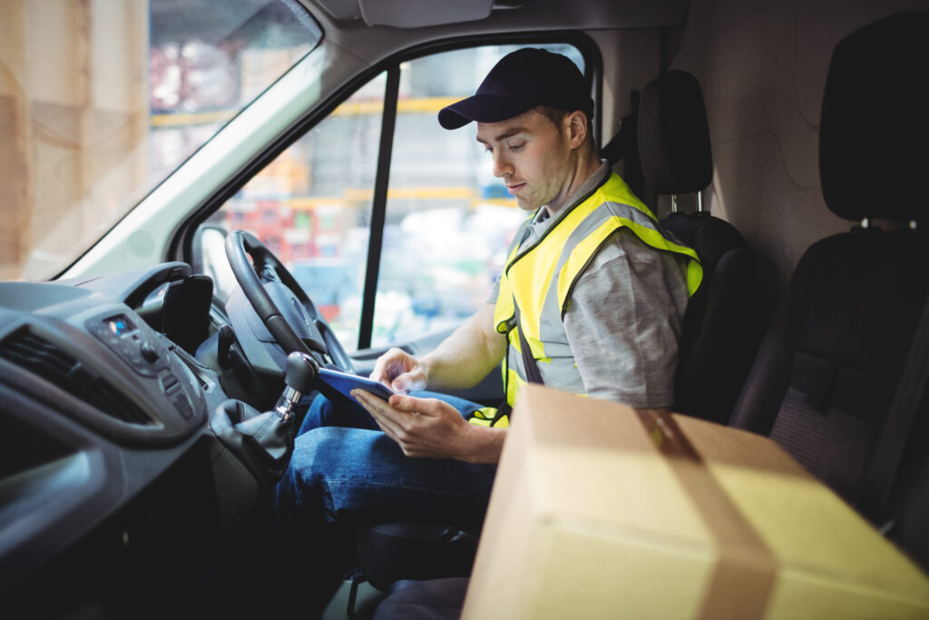
Managing deliveries and collections can be challenging.
There are many stakeholders to keep happy – from customers and drivers to customer services and transport management. Our solutions and products help you to keep all elements running smoothly, in a live, real-time environment.
We understand the need to have complete visibility into deliveries and collections – here’s an audit trail you can access easily and rely on completely.
Struggling to keep track of deliveries?
Managing a high delivery volume can quickly spin out of control without the right solution in place.
Dealing with spiralling operational costs?
Fuel and driver costs can mount up when you lose visibility of events as they occur.
Finding it hard to retain drivers?
Drivers are in high demand – transport teams are finding it increasingly tricky to recruit and retain.
Did you know?
Where problems are solved
Delivery management solutions that tie up loose ends
Control delivery visibility
Visibility into deliveries and collections equals better resource management. Delivery management software offers real-time tracking, so you can monitor driver locations and the status of deliveries.
Track and trace items
Easily scan products at every stage of the delivery or collection process. This will reduce stock loss through human error, or theft.
Enhance customer service
Place control in your customers’ hands with by giving them a self-serve portal. All customers can check the live-status of all orders, quickly and simply.
Cut customer service costs
Automated communication with regular delivery updates minimises the need for manual intervention by the customer service team. With fewer delivery issues, the need for a high number of customer service employees drops.
Attract and retain drivers
Delivery management software keeps drivers happy by optimising routes to reduce stress, providing clear instructions and real-time updates. Drivers are more content with efficient scheduling and a predictable and manageable workload.
Reduce disputes with customers
Pin Live provides a time-stamped, location-stamped proof of delivery, backed up by photos and signatures – maintaining transparency and accountability. Proof of delivery offers clear, indisputable evidence that packages have been delivered as promised.
We bring our expertise to you
Leading companies choose our delivery management solutions for a reason
Flexible and scalable
Pin Live is designed to run in a live environment, via an intuitive cloud-based interface and an app for handheld devices.
Easy integration
Manage routes in real time by integrating with Pin Routes – giving you a full audit trail and delivery visibility.
Fleet management
Improve operational control – carry out and record vehicle checks, report defects, and easily manage vehicles and drivers. Fully configurable for your organisation.
Understand the current landscape
Streamline your logistics with a demo of Pin Live
Book a demo today to see how Pin Live can transform your delivery management. Improve real-time visibility, enhance customer communication, and optimise fleet management with our easy-to-use platform. Take the first step towards smarter logistics—book now!
Awards & accreditations


Want to know more about us?
Related services
Supply chain planning
Make key decisions on distribution network planning, testing a myriad of scenarios and moving parts to provide realistic, data-driven answers.
Route optimisation
Use best-in-class algorithms, creating routes to meet all your requirements at the least cost, saving money, time, carbon emissions and your sanity.
Logistics consulting
Benefit from our expertise and our toolkit, using us for supply chain and logistics consultancy projects when you don’t have the time, expertise, toolkit or inclination.
Transport management
Our transport management software helps you keep complete visibility – of drivers and vehicles – so all aspects are seamless, with real-time updates.
Fleet management
Managing your fleet with an end-to-end system, tracking the status of each vehicle, while ensuring all vehicles are roadworthy and compliant.
FAQs
Answers to common questions about delivery management.
Delivery management involves overseeing the entire process of transporting goods from suppliers to customers. It includes real-time tracking, driver coordination, and ensuring timely, accurate deliveries.
Effective delivery management improves operational efficiency, reduces costs, enhances customer satisfaction, and provides visibility and accountability throughout the delivery process.
Pin Live enhances operational control, simplifying the management of daily operations and reducing costs. It provides better visibility for customers, improving service and fostering loyalty. By reducing customer service calls, it lowers associated costs.
Additionally, it simplifies vehicle fleet management, ensuring more efficient and effective utilisation of resources. Plus, it integrates with Pin Routes for an end-to-end optimised solution.